场景介绍
本章节将向您介绍如何在地图上绘制折线、设置折线分段颜色、设置折线可渐变、绘制纹理。
折线主要用于展示步行、驾车、骑行等各类导航路线,同时可记录并呈现用户的运动轨迹及历史行程信息。此外,在区域边界标注、距离测量、管网线路布局以及活动路径可视化等场景中也有广泛应用。
5.0.3(15)开始,支持折线绘制纹理功能;26.0.0开始,支持折线添加文字。
接口说明
添加折线功能主要由MapPolylineOptions、addPolyline和MapPolyline提供,更多接口及使用方法请参见接口文档。
| 接口名 | 描述 |
|---|---|
| MapPolylineOptions | 折线参数。 |
| addPolyline(options: mapCommon.MapPolylineOptions): Promise<MapPolyline> | 在地图上添加一条折线。 |
| MapPolyline | 折线,支持更新和查询相关属性。 |
[h2]添加折线
-
导入相关模块。
import { MapComponent, mapCommon, map } from '@kit.MapKit'; import { AsyncCallback } from '@kit.BasicServicesKit'; -
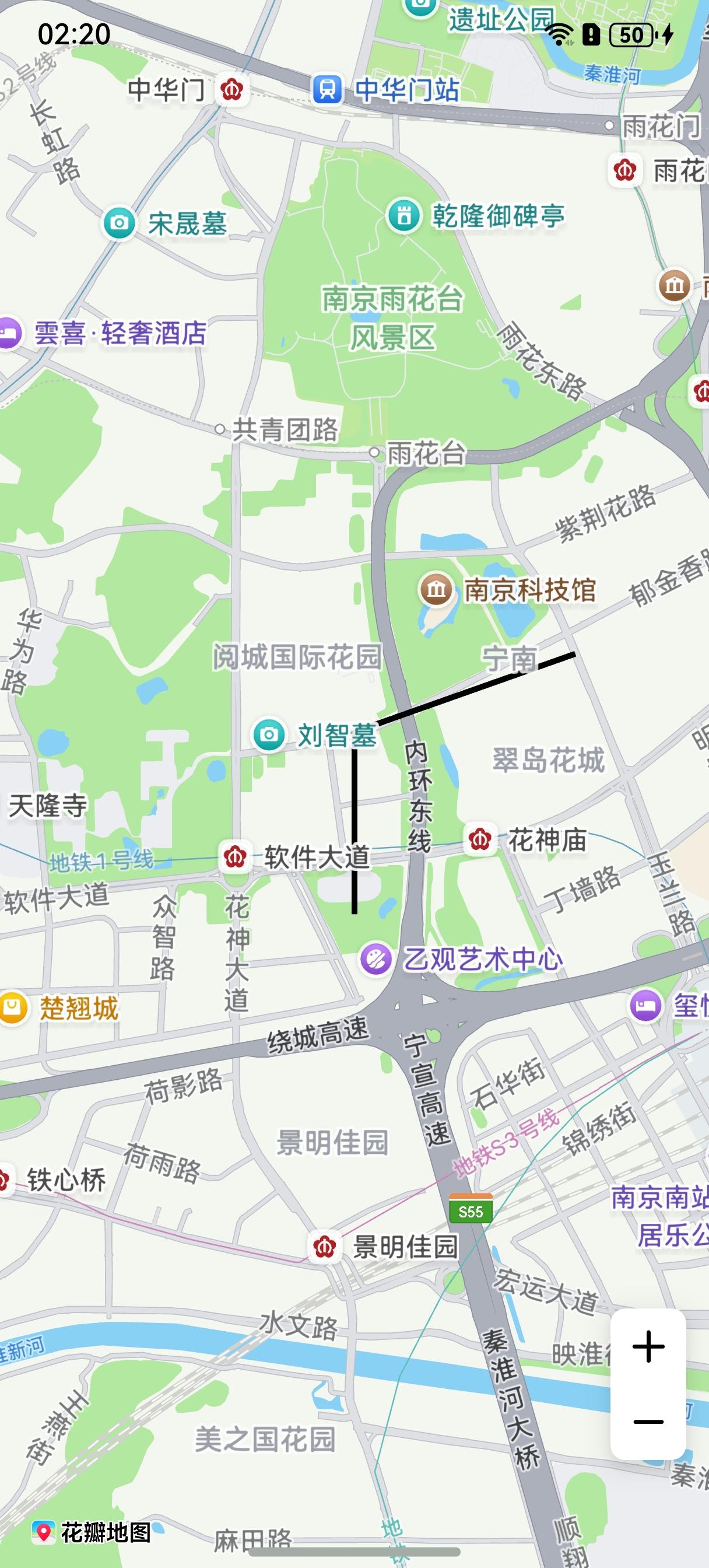
添加折线,在callback方法中创建初始化参数并新建MapPolyline。
@Entry
@Component
struct MapPolylineDemo {
  // ...
  private mapOptions?: mapCommon.MapOptions;
  private mapController?: map.MapComponentController;
  private callback?: AsyncCallback<map.MapComponentController>;
  private mapPolyline?: map.MapPolyline;

  aboutToAppear(): void {
    // 地图初始化参数
    this.mapOptions = {
      position: {
        target: {
          latitude: 31.98,
          longitude: 118.78
        },
        zoom: 14
      }
    };
    this.callback = async (err, mapController) => {
      if (!err) {
        this.mapController = mapController;

        // polyline初始化参数
        let polylineOption: mapCommon.MapPolylineOptions = {
          points: [
            { longitude: 118.78, latitude: 31.975 },
            { longitude: 118.78, latitude: 31.982 },
            { longitude: 118.79, latitude: 31.985 }
          ],
          clickable: true,
          startCap: mapCommon.CapStyle.BUTT,
          endCap: mapCommon.CapStyle.BUTT,
          geodesic: false,
          jointType: mapCommon.JointType.BEVEL,
          visible: true,
          width: 10,
          zIndex: 10,
          gradient: false
        }
        // 创建polyline
        try {
          this.mapPolyline = await this.mapController.addPolyline(polylineOption);
        } catch (e) {
          console.error(`Failed to create the mapPolyline, code is:${e.code}, message is ${e.message}`);
        }
      } else {
        console.error(`Failed to initialize the map, code is:${err.code}, message is ${err.message}`);
      }
    };
  }

  build() {
    // ...
      Stack() {
        Column() {
          MapComponent({ mapOptions: this.mapOptions, mapCallback: this.callback });
        }.width('100%')
      }.height('100%')

      // ...
  }
}
[h2]设置折线分段颜色
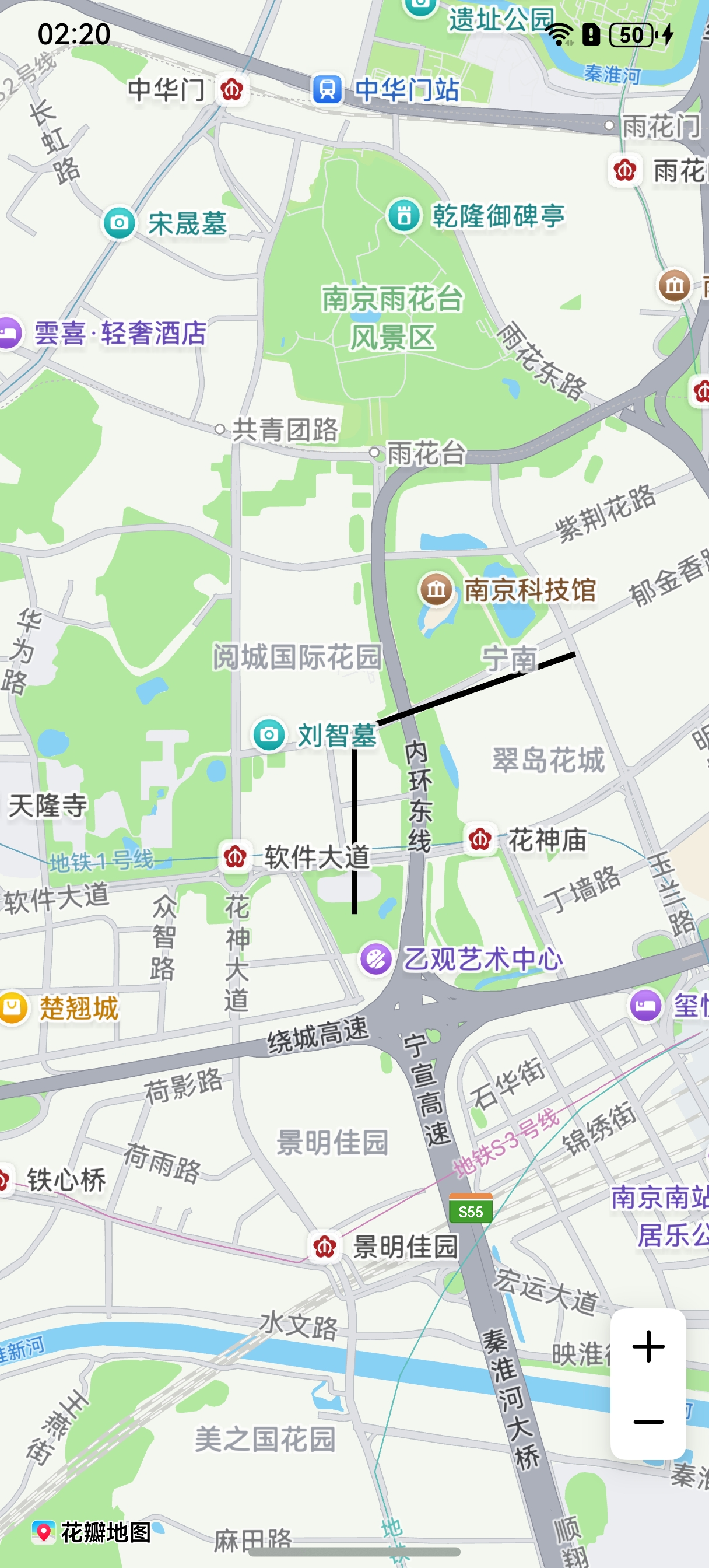
方法一:新建折线时在MapPolylineOptions的colors属性中设置折线分段颜色值。
let polylineOption: mapCommon.MapPolylineOptions = {
  points: [
    { longitude: 118.78, latitude: 31.975 },
    { longitude: 118.78, latitude: 31.982 },
    { longitude: 118.79, latitude: 31.985 }
  ],
  clickable: true,
  startCap: mapCommon.CapStyle.BUTT,
  endCap: mapCommon.CapStyle.BUTT,
  geodesic: false,
  jointType: mapCommon.JointType.BEVEL,
  visible: true,
  width: 10,
  zIndex: 10,
  // 设置颜色
  colors: [0xffffff00, 0xff000000],
  gradient: false
}; 方法二:调用MapPolyline的setColors()方法。
let colors = [0xffffff00, 0xff000000];
this.mapPolyline.setColors(colors);

[h2]设置折线可渐变
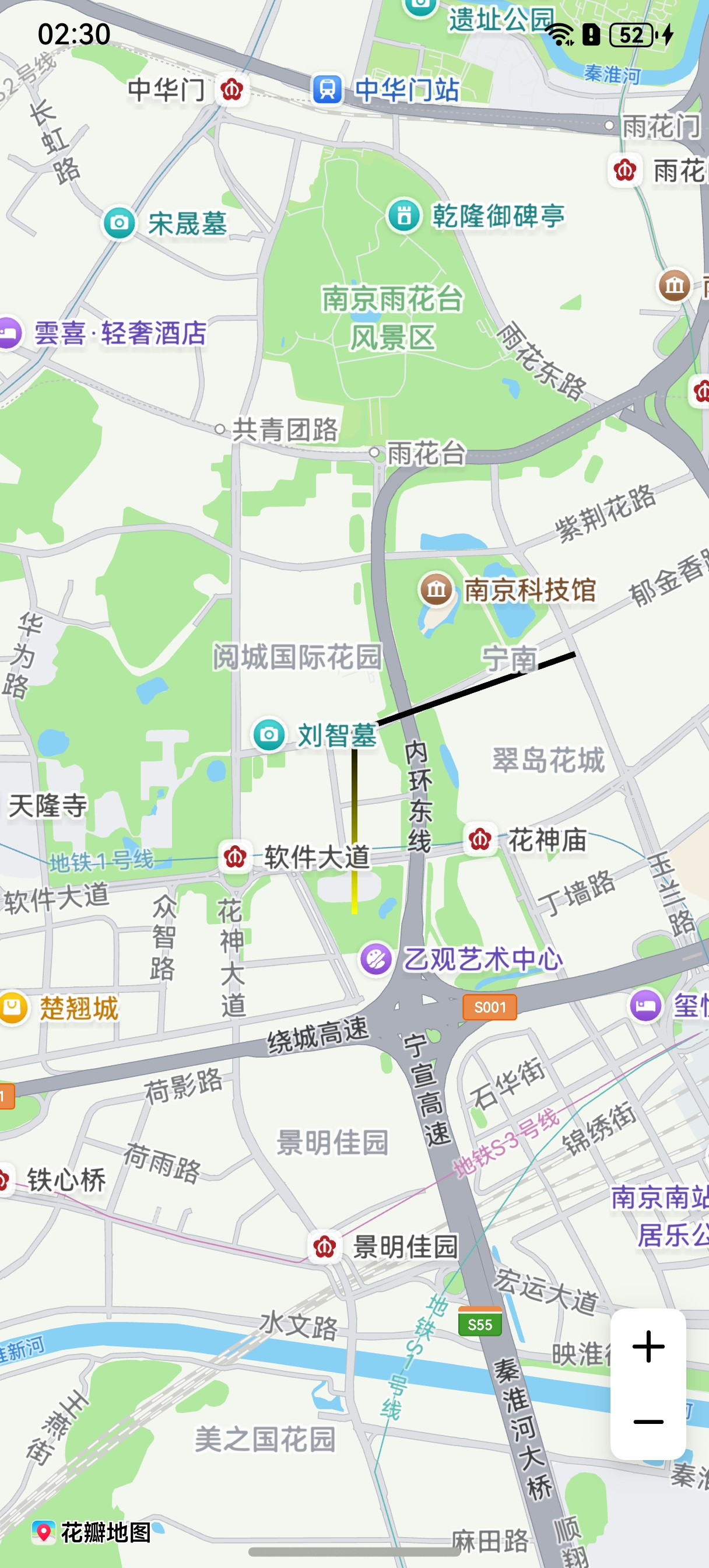
方法一:MapPolylineOptions的gradient属性设置为true。
let polylineOption: mapCommon.MapPolylineOptions = {
  points: [
    { longitude: 118.78, latitude: 31.975 },
    { longitude: 118.78, latitude: 31.982 },
    { longitude: 118.79, latitude: 31.985 }
  ],
  clickable: true,
  startCap: mapCommon.CapStyle.BUTT,
  endCap: mapCommon.CapStyle.BUTT,
  geodesic: false,
  jointType: mapCommon.JointType.BEVEL,
  visible: true,
  width: 10,
  zIndex: 10,
  colors: [0xffffff00, 0xff000000],
  // 设置颜色折线可渐变
  gradient: true
}; 方法二:调用MapPolyline的setGradient()方法。
this.mapPolyline.setGradient(true);
[h2]绘制纹理
方法一:新建折线时在MapPolylineOptions的customTexture属性设置折线纹理。
let polylineOption: mapCommon.MapPolylineOptions = {
  points: [
    { latitude: 32.220750, longitude: 118.788765 },
    { latitude: 32.120750, longitude: 118.788765 },
    { latitude: 32.020750, longitude: 118.788765 },
    { latitude: 31.920750, longitude: 118.788765 },
    { latitude: 31.820750, longitude: 118.788765 }
  ],
  clickable: true,
  jointType: mapCommon.JointType.DEFAULT,
  width: 20,
  // 图标需存放在resources/rawfile目录下
  customTexture: 'icon/naviline_arrow.png'
} 方法二:调用MapPolyline的setCustomTexture方法。
await this.mapPolyline.setCustomTexture('icon/naviline_arrow.png'); 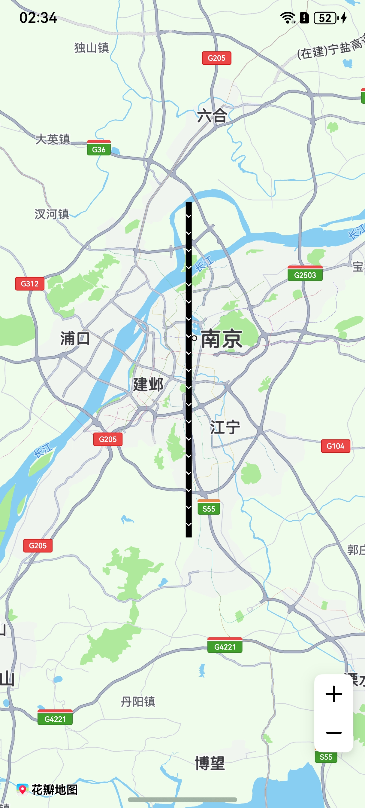
[h2]折线设置分段纹理
新建折线时利用在MapPolylineOptions的customTextures和customTextureIndexes属性设置折线分段纹理。
import { image } from '@kit.ImageKit';

// ...
// 数组存放图片内容
let customTextures: (ResourceStr | image.PixelMap)[] = [];
// 图标存放在resources/rawfile,'icon/img.png'参数值传入rawfile文件夹下的相对路径
customTextures.push('icon/img.png');
customTextures.push('icon/img_1.png');
let cusIndexNumber: number[] = [];
// cusIndexNumber数组长度与折线点数量必须相同,数组元素内容与customTextures下标相对应,图片从数组第二个元素开始选择
cusIndexNumber.push(0, 0, 1);
// polyline初始化参数
let polylineOption: mapCommon.MapPolylineOptions = {
  points: [
    { longitude: 118.78, latitude: 31.975 },
    { longitude: 118.78, latitude: 31.982 },
    { longitude: 118.79, latitude: 31.985 }
  ],
  clickable: true,
  startCap: mapCommon.CapStyle.BUTT,
  endCap: mapCommon.CapStyle.BUTT,
  jointType: mapCommon.JointType.BEVEL,
  width: 30,
  // 图标需存放在resources/rawfile目录下
  customTextures: customTextures,
  customTextureIndexes: cusIndexNumber
};
let mapPolyline = await this.mapController.addPolyline(polylineOption); 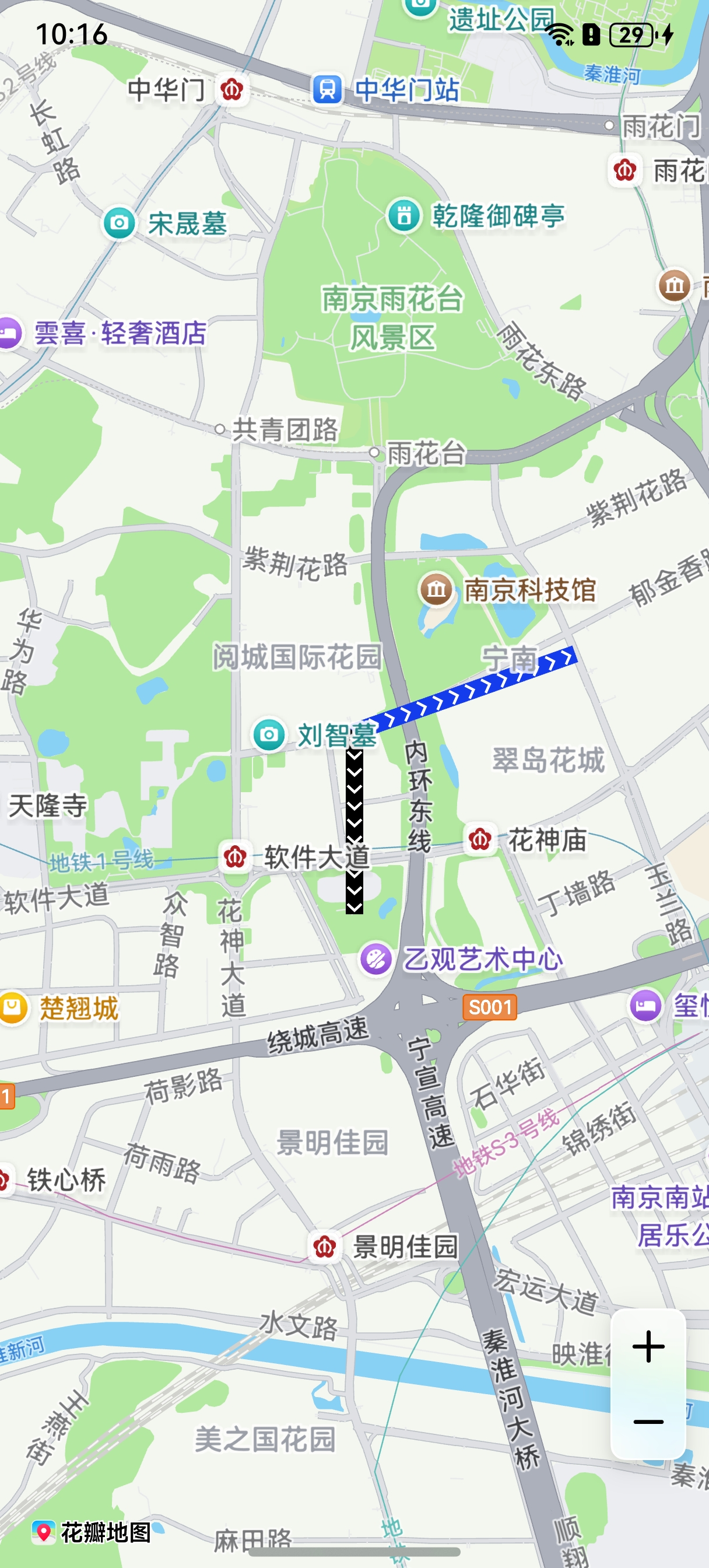
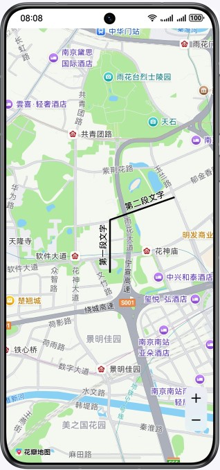
[h2]折线添加文字
新建折线后可调用MapPolyline的addLineText方法给折线添加文字,通过removeLineText方法可删除折线文字。
// 添加折线文字
let textLine: mapCommon.LineText = {
  lineNames: ['第一段文字', '第二段文字'],
  lineNameIndexes: [0, 1, 1, 2],
  nameOnRight: false,
  color: 0xFF000000,
  fontSize: 15,
  strokeColor: 0xFFFFFFFF,
  fontStyle: 0
};
this.mapPolyline.addLineText(textLine);
// ...

// 删除折线文字
this.mapPolyline.removeLineText();